
Will Canadian wildfire smoke reach Charlotte? What the NWS says.
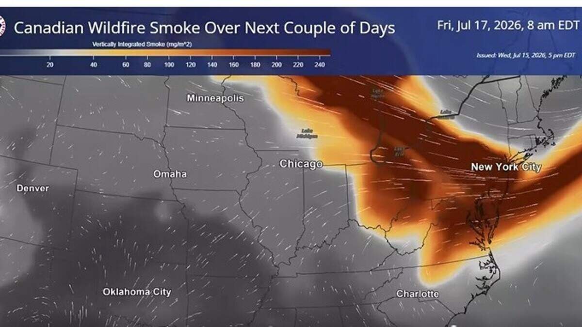
Charlotte-area forecasters are monitoring Canadian wildfire smoke choking a wide swath of the country, from the Great Lakes to Pennsylvania and New York.
A National Weather Service map of the smoke’s movement shows the weak outer edge near Charlotte on Friday.
The latest weather models Thursday put the smoke Friday well to the north of Charlotte, with Virginia at greatest risk of reduced visibility, NWS meteorologist Jake Wimberley told The Charlotte Observer.
The Interstate 64 corridor from Roanoke to Richmond is at greatest threat, he said.
Charlotte and the rest of Mecklenburg County face a second straight Code Orange air-quality alert day Friday issued by the N.C. Division of Air Quality, but that’s because of ozone, not smoke, Wimberley said.
Gaston County and the South Carolina counties of York and Chester also fall under the alert.
Code Orange means unhealthy air for “older adults, children, active people and those with lung or heart disease.”
“Air quality is definitely going to be worse than usual on Friday,” but not because of harmful particulates from the smoke, Wimberley said.
Code Orange is in effect from 10 a.m. to 8 p.m.
The best chance for Charlotte-area residents to see the smoke is to look north, Wimberley said.
Winds from the south could reduce the chance of smoke in Charlotte this weekend, as could clouds and cooler temperatures, Wimberley said.
Charlotte forecast
Friday in Charlotte is expected to remain sunny and dangerously hot, with a high of 99 and a heat index of 104, according to the NWS forecast. The heat index is what the outdoors feels like combining humidity and temperature.
Highs are forecast to be 95 on Saturday, 92 on Sunday, 90 on Monday, 93 on Tuesday and Wednesday and 89 on Thursday, the forecast showed.
This story was originally published July 17, 2026 at 5:00 AM.