Are you in a high-risk COVID zone? This map tracks current virus spread in North Carolina
Search the map below to see how the CDC rated the COVID-19 level in your county.
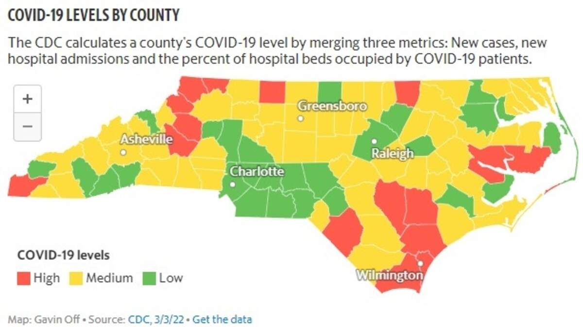
The CDC’s new calculations are designed to help local leaders decide if additional steps are needed to stop the spread of the virus.
In green counties, local officials can drop any indoor masking rules. Yellow means people at high risk for severe disease should be cautious. Orange designates places where the CDC suggests masking and other rules should remain in place.
How a county comes to be designated green, yellow or orange will depend on its rate of new COVID-19 hospital admissions, the share of staffed hospital beds occupied by COVID-19 patients and the rate of new cases in the community, according to the CDC.
Currently, 25 of the state’s 100 counties are considered green, including Mecklenburg County. According to the current CDC thresholds, 16 counties across North Carolina fall into the orange designation where virus spread is considered high and mitigation measures should remain in place.
This story was originally published March 8, 2022 at 12:32 PM.